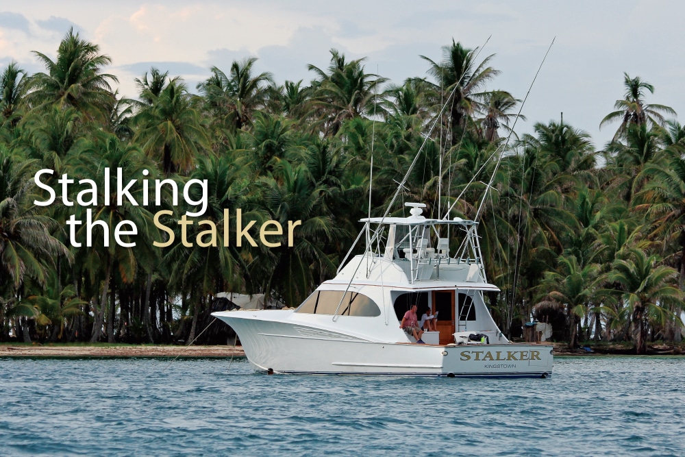
I’d just muddled through my first year as a yacht broker when Gary Mabry and Charles Nail contacted me about buying a new sport-fisherman. The two recently retired gentlemen were looking to fish locally and do a little traveling too. I recommended they purchase an unfinished 57 Spencer Yachts boat that I knew about to get them started. The next step was to complete the boat and find them a captain.
However, since this was their first boat, they were a little concerned with putting their new investment in the hands of someone they didn’t know. I ran a boat for their former business partner some years earlier, so we all knew each other pretty well. They asked if I would run Stalker for them until they found a captain they liked. I’d been cooped up in the office for a while, so I figured it could be a good opportunity to do a little traveling. After getting the go-ahead from my wife and my brokerage boss, I accepted the offer, but with a couple of conditions.
I told them my deal could be for no more than one year, and we had to hit at least two of these five places: Mexico, St. Thomas, Venezuela, Panama and Costa Rica. I did not want to take a job baby-sitting a boat that sat at the dock. To my surprise, they agreed. And they wanted to hit all five spots in one year!
Fast-forward to now coming up on nine years later, and we are still going strong; we added Cabo San Lucas, Guatemala and the Galapagos Islands to the itinerary, but have otherwise stuck to the same busy schedule. Since we get around a lot on Stalker, I get asked what the best routes from one place or another are, along with many other questions. Any good captain is always concerned about where to get fuel, customs, immigration, agents, best grocery stores — you name it. Every trip is different. For instance, is your trip a delivery? Are you going to fish along the way? Will you have the boss on board, or just the crew? All these things can change a route, not to mention weather, breakdowns and other unforeseen acts of God!
Three Ways To Travel On Your Boat
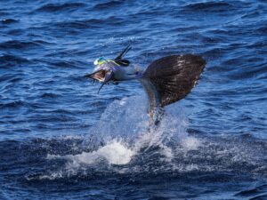
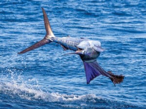
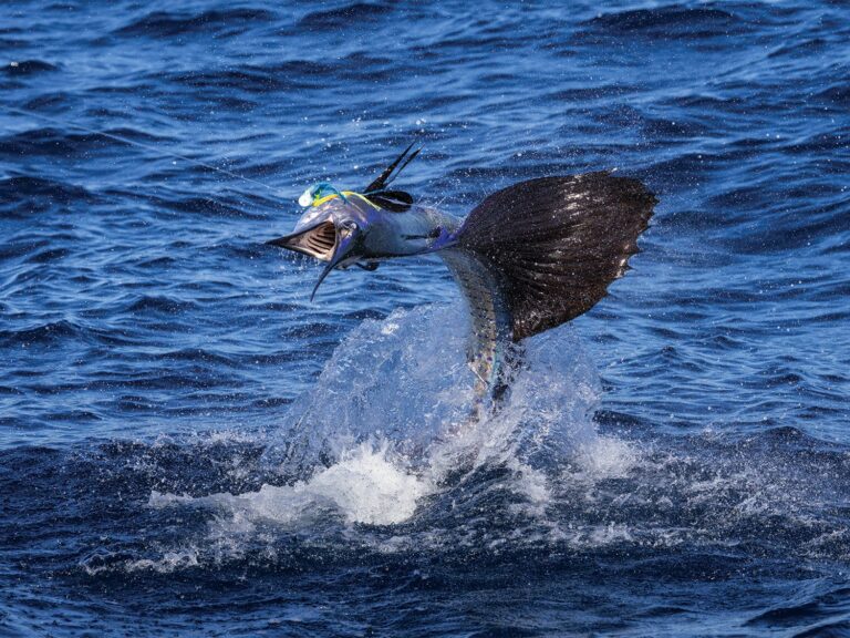
We have three different modes of travel when we take a trip on our own bottom. The first mode — used when the boss or bosses are on board — is fishing our way along. But we don’t want to fish in open blue water; we try to hit some kind of structure along the way. We’re always ready while running in case we see good conditions. You never know when you’ll find a big log full of bait or a big stack of birds to stop on. Unfortunately, fishing can take away from the mileage you can log in a day, making getting into your destination marina a little hard. So you have to be ready to swing into anchorages you find along the way or duck into marinas close by that may take you off course.
Our second and third modes of travel are with the crew. This is where we make our decision, based on weather and the schedule, to either chug the whole way or run.
To get to spots like Mexico, Venezuela, Panama and Costa Rica, you will need to chug overnight at some point. Chugging of course saves a lot of fuel, but more importantly, it extends your range. Chugging, however, saps all the fun out of traveling. One time, due to a short weather window, we chugged five days straight and then picked up and ran the last 150 miles of a 1,236-nautical-mile trip from Cabo San Lucas, Mexico, to Guatemala. We made the transit just four hours short of six days, only burning 1,170 gallons of fuel. If we had run at 25 knots and made a fuel stop on that same route, with all the checking in and out and the necessary paperwork, it would have taken seven and a half days, not to mention burning 2,500 extra gallons of fuel. (Not making the weather window to jump across the Gulf of Tehuantepec could have added another week waiting for the wind to stop blowing as well.)
But those five days of chugging almost drove us crazy! Before you try a jump of that distance, I would recommend starting out with shorter distances, say 350 to 400 miles, to get an understanding of your fuel burn and the process. The faster you want to make the trip, the more fuel your boat will burn. So go through the drill that comes with carrying extra fuel, and the process of transferring it into the tanks. It takes getting used to, and you want to know how to do it in heavy weather as well.
Most of the places I travel to now, I was lucky enough to have visited as a mate — with captains who had been there before. These captains only had charts and compasses to navigate by; there was no GPS back then. When I became captain, we used a much earlier edition of the color-screened GPS that all boats carry now. But I still carry all the paper backup charts for every area I travel through, in case there’s some kind of problem with the electronics.
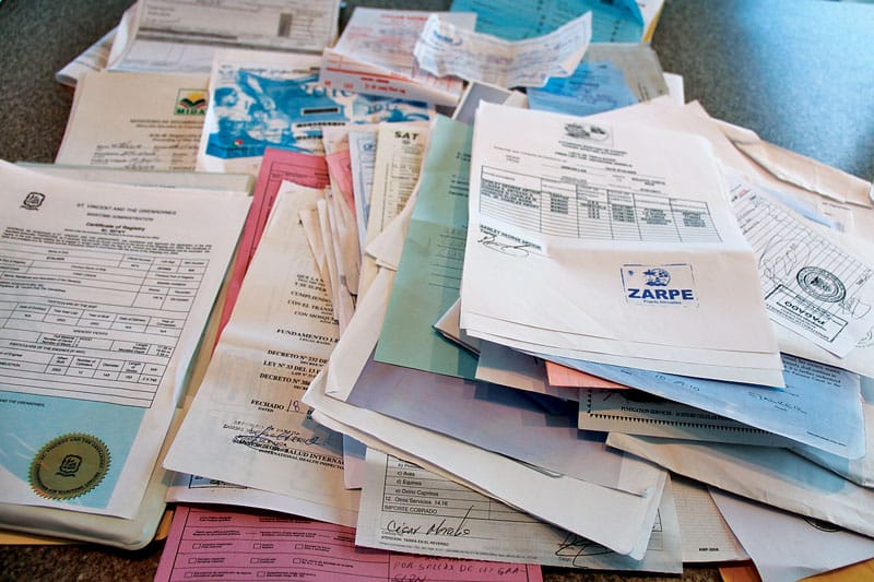
And since it’s impossible to know or remember every port, I also carry the latest mariners’ guidebooks. Regulations change, new marinas open and old ones close, and the latest guidebooks keep you informed. On several occasions, rough weather initiated a course change in the middle of a trip, and a guidebook helped give me the confidence to come into a port that I had not navigated before. Guidebooks also can give you a quick refresher on a port that you have not seen in years. Either way, they are a must-have for any captain! You can find all the books, charts and flags you need at Bluewater Books & Charts in Fort Lauderdale, Florida.
Taking A Boat To Cancun
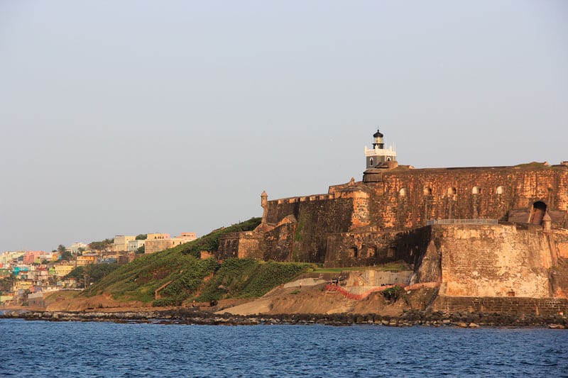
Our first trip on Stalker was the 330 nm nonstop trip to Cancun, Mexico. Lots of sport-fishing boats line the docks in Key West, loaded with fuel to make the jump. Although it’s not one of the longest trips to a sport-fishing destination, it can be a tough one. Most boats want to get a start in January, when cold fronts bring the hardest northerly winds. Add the strong currents of the Gulf Stream, and these north winds, or even the trade winds, can make for large seas and a rough passage.
Most sport-fishing crews cut their teeth on the overnight chug. It is important to really watch the weather for that window of opportunity. If you don’t have confidence in your ability to make the call to pull off the dock, pay for the services of a weather-forecasting company like Weather Routing Inc. You give them all your information, like the size of your boat and your speed, and they provide you with the best time to make the jump.
Since we have a 25-knot cruise boat, we like to pull out late in the afternoon and do a fast chug until the sun goes down. Then, once it gets dark, we pull it back to a slow chug of about 8 knots. Once the sun comes up, we go back up to our regular cruise. If all goes well, we get to the dock in Mexico before dark.

Taking A Boat To St. Thomas
Another trip we have done a lot is from Fort Lauderdale, Florida, to St. Thomas, U.S. Virgin Islands. It has to be the easiest trip of them all. These days, you can take a 25-knot boat and do a day’s run and still get in a marina before dark with no overnight chugging. We usually make the trip in seven days. The first stop is Nassau or Paradise Island, a distance of about 135 nm. We head to North Rock, just north of Bimini, and cross the bank to the Northwest Channel Light. Then we head to New Providence Island. If you leave early in the morning from Florida, you will get in and get cleared by customs and immigration before dark. The next morning, we leave a little late. I like a little sun to come up to cross over Yellow Bank.
There is plenty of water, but there are a number of coral heads in the middle of the 30 nm crossing to Beacon Key Light that you need to steer around before you get to deep water. Once you pass Beacon Key, you have a few choices: You can stop at Hawk’s Nest Marina on Cat Island, Flying Fish Marina on Long Island, or, my favorite, Rum Cay Marina on Rum Cay. This part of the Bahamas can sometimes run into fuel shortages, so calling ahead to find out the fuel status is a good idea.
The next stop, on day three, is the Turtle Cove Marina on Providenciales in the Turks and Caicos Islands. It’s about a 185 nm run from Rum Cay. I’ve found better sea conditions while making this run by keeping on the north side of Mayaguana Island. Once you have cleared the extended eastern reef line of Mayaguana, you switch from a 126-degree heading to a 139-degree heading to give you a nice quartering-sea angle for the last 40 nm.
Once you check in to Provo, make sure you have the clearance to the next port. All Latin American ports require clearance from your last port — no exceptions.
On day four you’re headed to the Dominican Republic, about a 185 nm run to Ocean World Marina. In my experience on a number of trips down, I’ve found that going down the west side of the Cacaos Bank gives you the best ride — even when it’s blowing, you make at least 90 miles of the trip in the lee.
On day five, head to the eastern end of the Dominican Republic — another 164 nm to Cap Cana Marina. Now, this is where good weather can save you a day. If there is little or no wind, I take off early and head straight to St. Thomas. It’s about 200 nm if you go on the north side of Puerto Rico, and about 212 nm if you run on the south side.
Usually the wind is blowing somewhere out of the east, but it could be northeasterly or southeasterly. Traveling on the south side might add a few more miles, but if the wind is coming out of a northerly direction, you are better off.
If the wind is blowing hard in Punta Cana and you don’t have the chance to shave the extra day off, beat the wind and head for the Club Nautico Marina in San Juan Harbor on the north side of Puerto Rico; it’s only 130 nm away. If you are traveling on the south side, head to Ponce Yacht Club in Ponce, Puerto Rico, which is a shorter run of only 109 nm.
From either marina, American Yacht Harbor Marina in Red Hook, St. Thomas, is only a short half-day run away.
Taking A Boat Through The Panama Canal
Hopefully, sometime in October, after enjoying a great marlin season in St. Thomas, you’ll pick up and head to the Panama Canal. November marks the end of the rainy season in Panama and the start of the fishing season for both Panama and Costa Rica. It’s 1,025 nm direct from St. Thomas to the town of Colón, Panama — the entrance to the Panama Canal. If you make this trip, there’s more chugging in your future. Fortunately, you have a few options to break the trip up into three or four sections.
We start our trip from St. Thomas to Panama by making the short 35-mile run over to St. Croix. Fuel prices are usually less in St. Croix than in St. Thomas, so it’s a good place to top off, and it also shortens the trip to Aruba. I usually pull into Christiansted Harbor and tie up at St. Croix Marine, conveniently located next to the customs dock. While the crew tops off the tanks and fills our two 200-gallon ATL fuel bladders, I take a quick walk to customs to do a check in/check out with the paperwork. Once cleared and fueled, we make the 430 nm jump to Aruba.
Upon arriving in Aruba, you must do your clearance at the official entry dock in Barcadera Harbor, which is on the south side of the island. Once cleared to enter, you have two nice marinas to choose from. If you want to be right in town, go to the Renaissance Marina in Oranjestad Harbor. Just outside of town, you have Eric Mansur’s Varadero Marina. When you’re ready to make the next jump, you must check out back at the customs dock. Don’t forget to get your clearance paper to show at your next port!
From Aruba to Panama, it’s 625 nm. On the way, you run along 229 nm of Venezuela’s coastline — there’s really nowhere to stop until you get to Colombia. There are at least two spots to stop in Colombia if you can get your insurance company to cover it. The first marina you encounter along Colombia’s coast is the new IGY Marina in Santa Marta, 263 nm from Aruba. The second marina you’ll come across is Club de Pesca in Cartagena, a 364 nm run. We stopped one year in Cartagena, but last year we shot straight to Panama from Aruba; it only took us about two days.
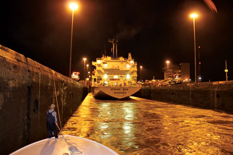
Once in Panama, we tie up at Shelter Bay Marina. It’s across the harbor from Colón, so it’s basically in the jungle. This is where we sit until we get our paperwork taken care of by our agent to do the canal crossing. It’s a good idea to communicate with a good agent before you get there to get the transiting schedule.
If your boat is longer than 65 feet, you need a pilot; if it’s shorter, you need a transit advisor. With the construction of the new canal transit, advisors are spread thin. This last time, we had to wait about eight days to get our advisor, but if we wanted to, we could have paid the extra $1,500 and gotten a pilot in two days.
It usually only takes about 10 to 12 hours to make the passage through the Panama Canal, but we have done one in six. Southbound transits are usually at night and northbound during the day. Once through to the Pacific side, you have two marinas to choose from; the closest one is La Playita Marina. It’s small, but it is expanding. The larger one, Flamenco Marina, lies just around the causeway, but it’s always very full and hard to get a long-term slip, so call ahead if you want to make sure you have a spot there.
Taking A Boat To Costa Rica
If you are twitching and in a hurry to get fishing, Golfito, Costa Rica, is 300 nm away — a very long day at a 25-knot cruise. And beware: Waters in this part of the world hold an excessive amount of debris. I regularly see entire trees longer than my boat, and with trunks more than 6 feet in diameter, floating in the water. Hitting one of these will definitely make for a bad month. So even if you have a fast boat and can make the trip in one day, I still recommend throttling back and taking two days to get to Golfito. No one wants to call the boss to tell him he will not be fishing on schedule because you ran over something. No one wants to do the boatyard drill south of the border, either.
Another option is the 178 nm run to Cébaco Island, right off Panama. You won’t find a marina at Cébaco, but you can hook up to the mothership that’s moored in Cébaco Bay. The boat holds more than 50,000 gallons of fuel, which makes it a great place to stop over for the night. They also have moorings for you to tie off to, so you don’t have to worry about putting your anchors out.
After a night in Cébaco Bay, you only have a 158 nm run to Golfito, Costa Rica. There are two marinas in Golfito Bay: Fish Hook Marina and Banana Bay Marina. I usually tie up at Banana Bay, because they do a great job of getting all your check-in paperwork together. If the owner of the boat is not traveling with you, don’t forget to get a notarized affidavit stating that you as the captain have permission to bring the vessel into the country. Without it, you’re stuck!
Once you are ready to move on from Golfito and start heading up the coast, you have three nice options for marinas. The first one you will come to, at 107 nm, is the brand-new Marina Pez Vela in Quepos. Your second choice, at 135 nm, is the Los Sueños Marina in Herradura. The third marina is the also brand-new Papagayo Marina, located in Bahia Culebra, which is a small bay in the Gulf of Papagayo and about 230 nm from Golfito. If you are headed to Guatemala, Papagayo Marina is the best spot to make your last stop to provision and check out in Playa del Coco. The marina will give you info on an agent to get your paperwork in order.
Taking A Boat To Guatemala and Mexico
Guatemala has only one real marina, the Marina Pez Vela, and it is located in Puerto Quetzal, a 360 nm run from Marina Papagayo. When you clear here, you also need a notarized affidavit from the owner.
Making the trip up to Guatemala and Mexico requires that you pay a bit more attention to the weather. Winds blowing 30 knots on the Caribbean side can accelerate to gale force when funneled through mountain passes. If you plan to continue north to Mexico, Marina Pez Vela makes a great spot to stand by and wait for a weather window. It’s a 330 nm jump across the Gulf of Tehuantepec to Huatulco, Mexico, and the Tehuantepec is famous for its dreaded gale-force winds. Make sure you get an updated weather report before pulling out.
Traveling from Costa Rica to Cabo San Lucas
Last year we decided to leave out of Costa Rica and head up to Cabo San Lucas, Mexico, at the end of the fishing season in May. It’s about a 1,280 nm trip. We intended to make a number of stops along the way to see the sights in each town and fish the local waters.
We made our first jump from Los Sueños Marina straight to Huatulco, Mexico — a 771 nm, three-and-a-half-day chug. Huatulco has two marinas, but only Marina Chahué is available for transient boats.
Our next stop, Acapulco, was only 205 nm from Huatulco and had two large marinas to choose from. I’d stopped here two times before to get fuel, and both marinas were very full both times. The last time I pulled in here, we had to spend the night on the fuel dock at Club de Yates de Acapulco, but they have power on the dock, so it wasn’t too bad. If you get in late after they are closed, you can pull in, tie up and plug in; just make sure you get going early the next day.
The next stop on your trip north should be Marina Ixtapa in Ixtapa-Zihuatanejo, a 125 nm mile run from Acapulco. With more than 600 slips, Ixtapa is one of the largest marinas in Mexico, so there’s never a problem getting a slip. Keep an eye out for the saltwater crocodiles, however; the marina is full of them.
For the next passage, you can either head for Manzanillo or Barra de Navidad — both are less than 200 nm from Ixtapa. I’ve stopped for fuel at both, and both times, one spot was out of fuel. Supposedly, this is a pretty common phenomenon at these two marinas, so call ahead and see who has the fuel before you leave. At Manzanillo, you stay at Brisas Las Hadas, a small marina connected to a large resort. It’s a Mediterranean-style mooring, so it’s not the best in bad weather. Barra de Navidad’s marina is also part of a resort, the Bahia Grande Hotel. We waited out a small hurricane in this marina and only had winds up to 40 mph — it turned out to be a great spot to ride out the storm.
Puerto Vallarta and Nuevo Vallarta are 125 nm from Barra de Navidad, and they offer up three large marinas to host your stay. The Marina Vallarta, Paradise Village Marina and Marina Nuevo Vallarta have more than 800 slips among them, so finding a spot for either a short- or long-term stay shouldn’t be a problem.
From Puerto Vallarta, Los Cabos is only 288 miles away, so you can either get up early and make a long day of it or break the trip up by going a little bit out of your way to stop in Mazatlan 175 nm away. If you have taken the Mazatlan route, it will be another 178 nm to reach the Marina at Porto Los Cabos.
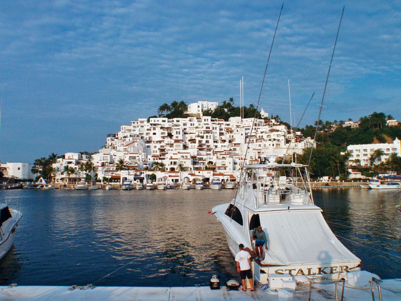
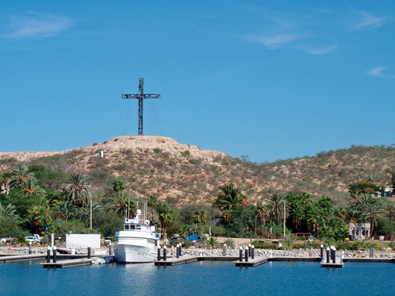
We spent August and September in Los Cabos to take advantage of its proximity to the fine striped marlin fishing in the Sea of Cortez. Once November came, we moved over to the Cabo San Lucas Marina, about 15 miles west. You can choose between two marinas in Cabo San Lucas: the IGY Cabo San Lucas Marina and the much smaller Marina de Baja.
You’ll find many more small ports along the Mexican coast to stop in and explore, but these are the ones we picked to match up with our fuel range and what the owners wanted to check out. The best guidebooks that I’ve found for this section of coastline come from Mr. and Mrs. Rains. The husband-and-wife captain team have two books. Book One takes you from Florida to Guatemala, and Book Two takes you from southern Mexico to California and includes the entire Sea of Cortez. They are a must-have on any trip through the canal.
Like I said, I always carry the latest guidebooks and most up-to-date charts to avoid any surprises. While a great trip should include a good deal of adventure and exploration, surprises should be kept to a minimum when it comes to making your way at sea.