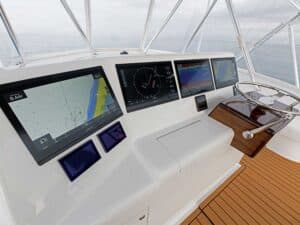
multifunction unit
There was a time — although most of us (myself included) probably can’t remember it — when the only fish-finding tool on your boat was your eyes. Then along came flashers, which account for my earliest memories of angling-oriented electronics. Paper graphs, and then LCDs, soon followed. Jump forward a couple of decades to the high-definition, multifrequency, supersensitive, überpowerful, idiot-proof (well, almost) units of today. Spotting fish beneath and around our boats is now far easier than it was when we stared intently at those blinking lights, waiting for an extra blip or three to appear on what we called a screen in the puerile days of recreational marine electronics. But before we can take advantage of our modern ability to see the fish beneath the boat, we have to get the boat near the fish — and this presents one of the biggest challenges any angler faces. It all boils down to one question: Where will you point the bow after passing through the inlet? Will you pick the right canyon, heading for the part of the reef with the hot bite or running to the pinnacle that’s holding a host of hungry billfish? Or will you make the wrong call and spend all day chasing ghosts on the machine?
This is where other electronic accessories come into play and up your game. While sonar marks the obvious choice when you’re searching for fish that are close by, you need to use other tools to make sure you’re in the right ballpark in the first place.
Plotting a Solution
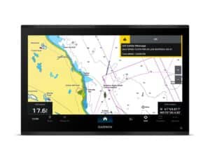
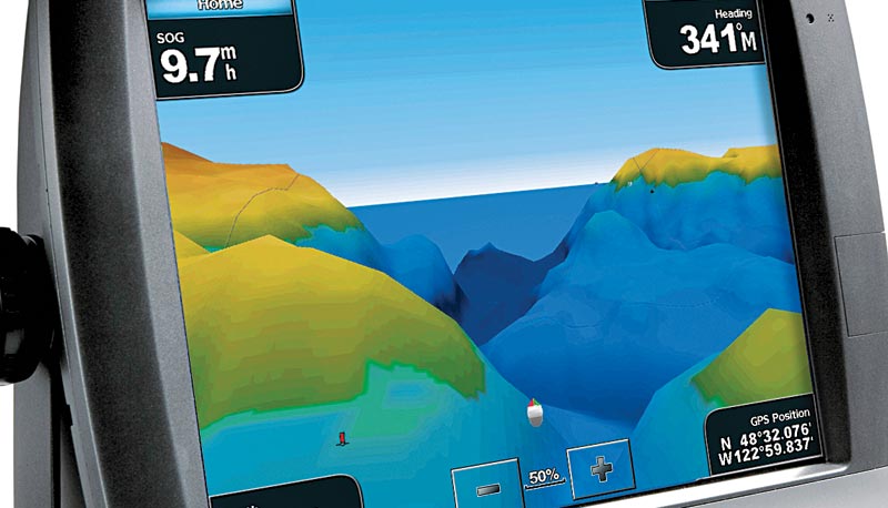
Chart plotters don’t immediately pop into most people’s heads when it comes to locating fish, but they can be helpful in several ways that go way beyond mere navigation. First off, their most obvious use is as a planning tool. With the amazingly detailed contour information and, in many cases, the 3-D underwater views they provide, chart plotters can help you get a good idea of where the fishy-looking spots are before you ever leave the dock.
Beyond that, virtually all modern plotters come with tidal information tucked away inside, either in their electronic brains or on the chart cards that come with them. I’m sure you don’t need anyone to tell you that currents resulting from those tides can play a huge role in where and when fish feed. And while major oceanic currents may dwarf the effects of tidal currents in many areas (the Gulf Stream being the obvious example), in some places tidal currents still play a role in when and where the bite will occur.
And since oceanic currents move, change and spin off eddies, they aren’t nearly as predictable as we might like to think. However, since they have a huge effect in some places on where the fish will be found, you need to know as much as possible about their probable location. Luckily, your chart plotter can come to the rescue here as well. If you subscribe to one of the satellite weather services, you may be able to bring up real-time information about currents right on
the screen. (If not, you can check out NOAA’s Environmental Modeling Center Web page for nearly real-time data and forecasting, look at NOAA’s predictions, or, for more detail, use one of the many for-pay services, like SeaStar Sport/Geoeye, Roffer’s Ocean Fishing Forecasting Service or Terrafin).
Automatic Identification System (AIS)
In certain areas of the country, an AIS unit is another useful electronic item that may help you locate commercial fishing boats, whose presence usually indicates a fishy area. Working in the immediate vicinity of a commercial fishing boat can be a boon. In many parts of the Atlantic, for example, tunas often follow close behind scallop boats and draggers, eating the discarded scallop gut and bycatch. If you know where the scallop boats are working, you can probably find the tuna. Also, paying attention to the location and trawling patterns of squid boats can put you on the swordfish if you plan to set up at night.
Sea Surface Temperatures
Sea surface temperature (SST) information is always helpful, and while it isn’t exactly an example of electronics, it can be viewed at sea on a number of electronic devices. You can display temperatures on your multifunction displays if you subscribe to a satellite weather service, but it should be mentioned that in many cases the level of detail will be lacking when compared to for-pay services. Companies like SST Online (sstol.com) vet and add to NOAA satellite shots, allowing you to “loop” data that’s been collected over several days. Determining the exact locations of breaks can be tough, and some of the weather-service-based systems update SST info far less often than desirable. Still, a midday update from the more detailed SST information you downloaded the night before can still be helpful, since it may assist you in identifying shifting trends in water composition.
When fishing close to shore (or if you have a potent cell booster), you may also be able to bring up SST info on your cell phone screen. Yes, even ’pods and ’droids can be used as fishing tools in this day and age. But between the small screen and the reduced access, using a cell phone for this purpose is less than ideal. In the best-case scenario, your boat will be rigged for offshore Internet access and have an onboard computer. That allows for highly detailed SST updates that are easy to view at any time, in virtually any place.
Radar
Of course radar belongs on this list, and it does have uses beyond the obvious one of bird spotting. You can also use your radar to get a long-distance view of lobster pot buoys laid out across a canyon edge. The pots are usually right on the drop, and trolling a standard zigzag pattern through the pot lines can often be productive.
Radar can also be used to gather intelligence on the competition. A few years back, during a very slow day of fishing, I heard a couple of captains talking about multiple bait balls and a red-hot bite. I knew both captains, but not well enough to ask them where they were. Then I heard them discussing a big freighter that was rolling through the area, closer to the fish than they would have liked. A quick glance at the radar showed a huge target next to two small targets, about 12 miles to the south — and I knew exactly which way to head. Yes, I know, this is almost as bad as radio-fishing (and, no, I’m not going to count the VFH as an electronic fishing tool!), but when fishing is tough and you need to make a change of course, the smart move is to swallow your pride and take every bit of info you can get.
**
Autopilot**
Even your humble autopilot can help steer you to the bite. Not only does it free up your hands for running teasers and kites, it also allows you to replicate successful patterns and try some new ones. The “cloverleaf” patterns in particular can be very effective when fish are holding over a specific spot. And on those days when fish only seem to hit baits as they cross in and out of the wake, you can set the autopilot to make regular S turns.
If you keep an open mind, you might even discover some new ways to utilize your existing electronics. Consider stereos. Some captains believe that cranking up the volume of certain tunes attracts fish, and I even knew one captain who glued a speaker to his hull so those good vibrations would be transmitted directly into the water. That got me thinking, and last summer I mounted a 300-watt subwoofer in my boat, and then recorded an audio file of baitfish struggling underwater. It’ll take a few seasons to determine if broadcasting these sounds has any real effect on the catch rate, so stay tuned — hopefully the fish will tune in too, and we’ll have yet another electronic item to help get those rods bent.
