Subscribe to Marlin magazine and get a year of highly collectible, keepsake editions – plus access to the digital edition and archives. Sign up for the free Marlin email newsletter.
Modern technology continues to transform our lives, and the fishing world is no exception. From sonars, stabilizers and power systems to social media and satellite phones, the paradigms are endless. But some of the most useful and accessible of these advancements are the satellite-data services that specialize in consolidating ocean conditions into a near-real-time, practical form for fishermen.
To start, it’s important to understand how this data becomes available. I spoke with Mark Hess, director of operations of SeaView Fishing, and Matthew Upton, president of ROFFS, to learn how these two industry leaders break down this data, and how all fishermen can benefit from services like these.
While it seems fishermen have no problem spending money to find fish, we still haven’t launched our own satellites into space, so the information that these companies use comes from data derived from National Oceanic and Atmospheric Administration and NASA satellites, as well as other space agencies and universities. All of the various fishing services are essentially using the same data, with the algorithms and breakdown of how this information is processed and interpreted being the difference between them.
Most of these satellites make multiple passes over Earth during a single 24-hour period. That data is then pieced together to create the most accurate picture of the conditions. Depending on the sensors, the spatial accuracy ranges, at best, from approximately 750 meters to about 1.1 kilometers, which is the size of a single pixel in these images. Variables such as sea-surface temperature, ocean color and currents can be most accurately determined by the two or three most recent passes, but cloud cover can often prevent a clear picture of a particular area. Services combat this problem by using models and cloud-free data over a period of time (one day, three days and five days) that utilize the clearest pixels from the most recent scans together with historical or climate data to fill in the gaps and form the best observation of the conditions. This means that while the model-based data might be the prettiest-looking picture, it might not be as accurate as shots from a more recent satellite pass. In most areas of the world, cloud cover is almost constant, so the model derived (or cloud-free data) is still an important part of putting together a fishing plan. Information such as mixed-layer depth, subsurface temperature and salinity are usually modeled projections. They’re still important elements to factor in, but it’s also necessary to keep in mind that the data might not be as exact as far as location.
The amount of resources might seem overwhelming, but you don’t have to be an oceanographer to use these services to help figure out where the best conditions are in your area. Overlays with multiple variables and bottom contours can be available directly on your multifunction display to compare and contrast. And if you want to take out even more guesswork, some services can provide a detailed, daily breakdown of exactly where they believe the best starting points are and why. But when looking at it from a DIY standpoint, it’s crucial to note that each of the various datasets is much more useful when combined with the others—putting the elements together like a puzzle. Either way, the goal is to locate oceanographic convergence zones—where two bodies of water butt against one another, creating a prime food-chain scenario. It is, however, important to remember that even the most thorough breakdown might not put you on the perfect spot as soon as you pull back the throttles, but at least you’re giving yourself the best chance at success before you leave the dock.
Temperature Is Key
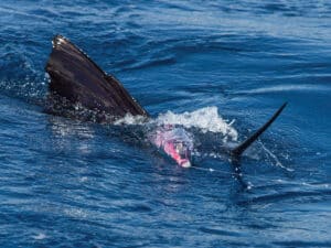
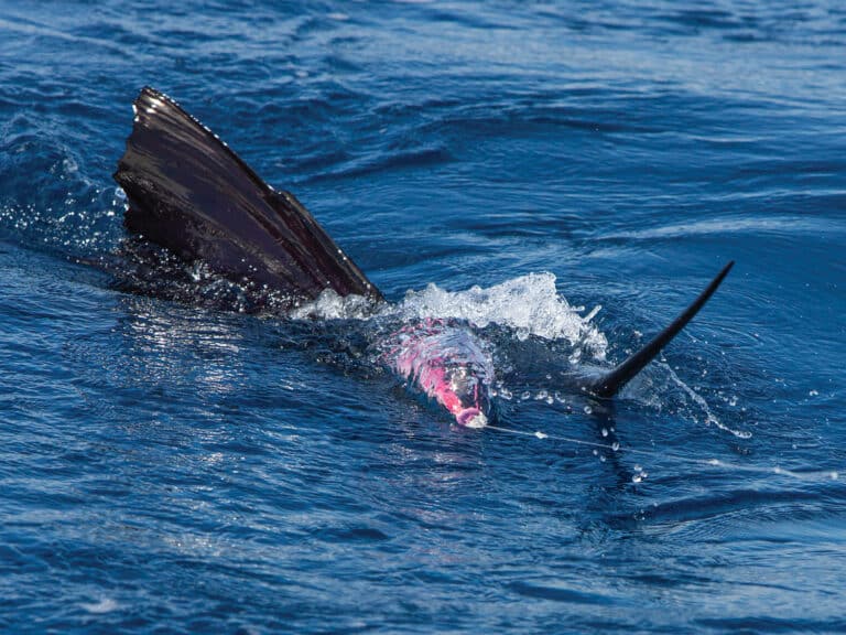
Sea-surface temperature is probably the data source we are most familiar with. Both Hess and Upton regard it as one of the critical pieces of the puzzle because it is a key factor in locating where pelagics feed and finding their preferred habitats, and it’s a great indicator of convergence-zone location. Cooler, nutrient-rich water intersecting with warmer—and oftentimes clearer—water that most gamefish prefer creates an ideal fishing scenario. What to look for here are temperature changes; and while small changes can certainly be productive, generally the sharper and more distinct the change, the better. These breaks can often represent an oceanographic convergence zone, where bait congregates. In tropical areas or seasonally in some areas, even a small change of a few tenths of a degree can show a convergence zone.
In areas with a large, dominant current, such as the Gulf Stream, fishermen want to look for eddies that consist of either warm-water filaments breaking away and spinning off the main current or cool-water eddies that rotate into the warm water. Upton tells me that the western Gulf Stream eddies have a counterclockwise rotation, so eddies will form with the leading edge pushing water inshore onto structure, and the trailing edge pulls offshore. Hess underscores that it’s not always about being on the leading edge, but rather more about finding an area where the warm water is being pushed into the richer, cooler water.
These eddies can also create upwellings that drive deep, nutrient-rich water to the surface. Smaller eddies move faster than larger ones and often dissipate much faster as well, sometimes lasting only a few hours. The larger the frontal zone, the more stable it will be, therefore making it more likely to hold predators. Also, the larger the eddy, the deeper it usually exists in the water column. Typically, an eddy that has remained intact and consistent for two to three days is best because the food chain is probably in motion at that point. The flip side is that if one of these bodies has been consistent for upwards of 10 days, then it might be fished out—either by people or predators. And because primary currents such as the Gulf Stream and Loop Current are always moving, it’s important to look at prior days to gauge the movement and stability of these eddies to anticipate how they’re working and where they’re headed.
Signs of Life
Water color, chlorophyll or plankton data is another key source when analyzing a fishing location. This data measures the amount of chlorophyll in the water and is a good indicator of how much phytoplankton (the foundation of the food chain) is in the area. What you’re looking for is a large concentration—or hard edge—that could indicate a convergence zone. Areas with high chlorophyll levels are often in green water, and because most pelagics are sight-based foragers that prefer clearer blue water, you want to find these two bodies in close proximity to one another.
The chlorophyll data, when used in conjunction with temperature data, can help narrow down an area with evidence of a true convergence zone. As with SST, stability is also important for chlorophyll data. Because the data is usually of a fresh phytoplankton bloom, it’s estimated that it can take two to five days for the zooplankton to begin feeding and, in turn, draw in baitfish and predators. Hess and Upton say that they use the chlorophyll data in conjunction with SST as the two primary factors in almost every fishing analysis to identify prime feeding zones.
Sea-surface-height anomaly data is derived from satellite altimeters that measure the height of the water level and show the sea-surface height in centimeters in reference to a long-term average. Winds, atmospheric-pressure changes and other forces push water in certain directions, which stacks up the ocean, effectively creating hills and valleys of water. This sometimes generates more-productive upwellings as nutrient-rich water from the depths is pulled to the surface. Because water wants to find its equilibrium, think of the water flowing downhill and toward the edges of the water mass; the bait will often follow this downhill movement. This data is also useful in finding—you guessed it—convergence zones.
Areas where high and low altimetry data meet are typically the places you want to be—just another factor to consider to reinforce the idea of a break when looking at SST and chlorophyll data. Sea-surface-height anomaly products are cloud-free and can be helpful, especially during periods when getting a clear satellite temperature shot isn’t possible. It’s also important to note that altimetry tends to be more accurate farther offshore, so this data might not be as useful for fisheries that occur within 20 or 30 miles of the shoreline.
Currents, Subsurface Temps and Thermoclines
Water movement is another form of satellite-derived and modeled data that can be used in conjunction with other data to help find areas where baitfish might be getting pushed into structure. Find areas where the arrows on the map pinch closely together, which shows the edges of a body of water and where it might butt against another. Current vectors can also show where a piece of water is headed and—when compared to a bathymetry chart—where it could be pushing on structure. This can also give you a better idea of which side of the structure to focus on. Just about every service offers bathymetry charts to overlay with other types of data, and finding a good section of water that might hold baitfish over structure can make the charts appealing.
Subsurface temperature and mixed-layer depth are two other data models Hess says might be underutilized. While both are not exact, model-formed data projections can reinforce the expectation of a convergence zone in a particular area. If the subsurface temp break appears to line up with the surface temp, then the information is rather hopeful. A consistent temperature below the surface can also indicate a more stable water-mass boundary. Mixed-layer depth is basically an estimate of where the thermocline is located in the water column; typically, plankton will be between the surface and the thermocline because it’s not able to penetrate the thermocline barrier.
If utilizing these charts to affirm a convergence zone, find areas where the mixed-layer depth changes. Think of this change as a wall that baitfish can use to their advantage to back their prey against when feeding. Like subsurface temperature, using mixed-layer depth can also aid in finding how deep the warm water stretches to help judge the stability of a section of water, or even how deep to drop a bait.
The Big Picture
To get the most out of these support services, you’ll need to compare multiple data forms to get the most complete view of the conditions. Simply looking at one or two forms alone tells only part of the story. Hess describes using each variable as a point system—meaning the more factors that line up in an individual spot, the greater amount of points it receives, and therefore is more likely to be productive.
For example, in places where there are large, dominant currents, you might put more weight on SST and chlorophyll to find the most productive eddies coming off the main current. In tropical locales such as Bermuda, Hawaii, the Bahamas and the Caribbean, you might want to put more emphasis on current, mixed-layer depth, and altimetry to find where baitfish could be congregating. By combining satellite information with personal experience, you’ll eventually see what combination of elements results in the most success in your area. Generally, though, regardless of where in the world you are, Upton says using the same principle of putting the datasets together along with bottom structure to find convergence zones is the goal.
Read Next: Learn more about the Costa Offshore World Championship, including how to qualify to participate.
This technology is rapidly advancing. New satellites with improved sensors are being added so older satellites can be phased out. Data delivery is also expanding, with many services offering mobile apps, and companies such as SiriusXM Marine offering its own real-time Fish Mapping datasets right on your boat’s electronics system. However, applying satellite imagery to fishing is, unfortunately, an inexact science. “We cannot see fish from space with satellite imagery yet,” Upton says, “but we can see their preferred conditions.” The objective of trying to catch large, fast-moving apex predators in a dynamic environment with a seemingly endless list of factors that could work for—or against—our success is no small task. Hess explains it like this: “Think about satellite-imaging data as another set of tools in your toolbox. It’s not going to guarantee your success, but why not stack the deck in your favor by using all the tools at your disposal?”
There’s never a substitute for time on the water, but by combining satellite data with what you’re seeing in real time, you’ll pick up patterns that will inevitably add to your success. Who knows? You might just wind up thanking your lucky stars (as well as the satellites) when you’re standing on the tournament stage this season.
Knowledge is Power
Capt. Devin Silas

“To be better fishermen, we must adapt—apply the information available, understand it, and understand why you caught fish. You can’t just use forecasting tools the day before you go; you need to also network with those who fished days prior, then review those reports and figure out why fish were caught there that day. The difference between being good and being great is putting in the effort to learn over a long span of time. It’s a little technical and complicated, but the work will pay off over time. If you don’t understand where you need to be and why, then you’re going to get your butt kicked by those who do.” seaviewfishing.com
George Robinson III
“I really believe in the current and temp data that ROFFS presents, and how those move from day to day. Pieces of water travel quite a distance overnight, but it does point you in the right direction because you can see exactly what it’s doing and where it’s going. Understanding water movement, fish movement, filaments, etc., takes years of experience to understand how to use this tool to improve your catching. You can’t just order a chart and get the whole picture. If you’re a weekend fisherman, you need to look at charts from that week to figure out where to go on Saturday; it takes some experience to translate what you’re seeing out there into catches.” roffs.com
Capt. Croft Upchurch
“I look at the water-temperature overlay for a week or more before a trip, noting any trends or shifts in water movement and how that might relate to both the wind and current. Finding points that have warm-water eddies sitting on or near them, watching over time to see those fingers forming off the main current, and then dialing in the temperature range to really get a feel for where the points and pinnacles are located are a few things I analyze when looking at the features of Fish Mapping. Last season we’d find the 2-degree temperature breaks exactly where, or within 2 miles of where, the program indicated they were, and we did really well because of it.” siriusxm.com/marine