In today’s age of weather satellites, apps and wire services, learning the “red sky at night” lore might be archaic. But in a spirit of safety, visual cues serve as reminders to be diligent in gathering information before heading to sea. Now, thanks to SiriusXM Marine Weather, a vast wealth of weather data can be gathered even at sea. And the data serves not just to avoid unpleasant or dangerous weather, but to make captains more efficient offshore.
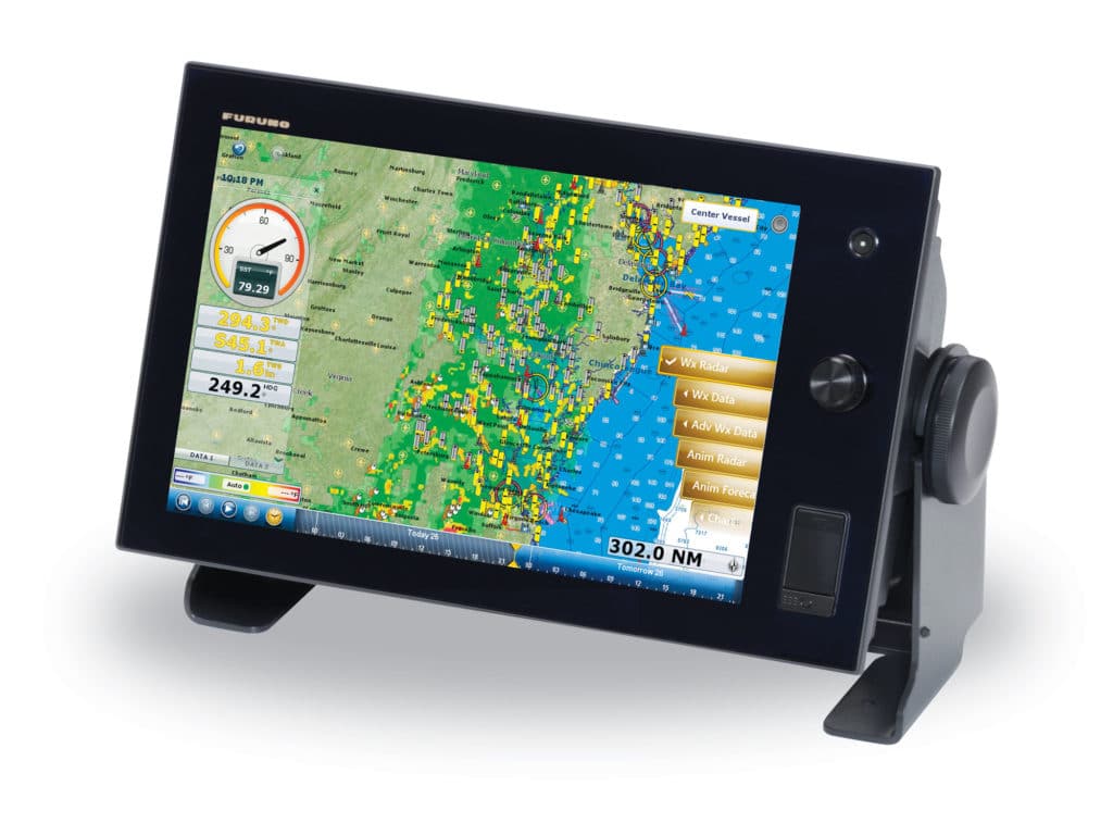
SiriusXM Marine isn’t new. It’s been providing aviators and mariners weather for 10 years. Even better, improvements with the major navigation-electronics makers (Furuno, Garmin, Simrad, Raymarine) mean skippers don’t need to rely on day-old data they laboriously scrubbed from Rutgers, NOAA and other weather services the day before. Today, SiriusXM weather subscribers can access 27 different weather data overlays on navigation suites even while at sea. If that’s not enough to entice you to opt for the monthly service, this will: It can be updated to the minute and overlaid on your chart plotter.
SiriusXM partners with The Weather Channel to deliver nearly real-time weather data to your battlewagon at sea up to 200 miles from any point of the coastal continental U.S. and Canada.
The Weather Channel gathers their data from NOAA, NEXRAD and other sources, crunches it for satellite transmission and pipes it to SiriusXM.
Available Data
Several different formats and sources of information are on the SiriusXM menu. While the extended list of data sources looks daunting, those less familiar basically enhance and influence the final output on your display.
GRIB, an acronym for gridded regularly distributed information in binary form, is a digital mechanism that has been used for decades to gather and transmit wind, sea state, and sea-surface temperatures for display. It generates a weather forecast by combining current data with past experience when similar data is present.=
METAR, or the Meteorological Terminal Aviation Routine Weather Report, has been the standard of aviation weather forecasting for decades. The reports employ current and historical weather station data from airport stations and others.
Offshore sea-surface temperatures are the holy grail of finding productive waters where marlin and other pelagics will be. And as you would expect, the holy grail comes only at the highest level of SiriusXM service: a monthly fee of $54.99.
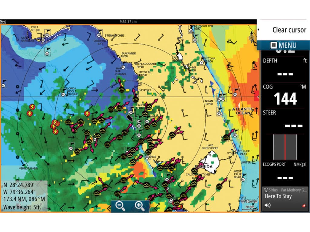
The magic for fishermen happens when they can overlay sea-surface temperature charts with wind and current data over their bathymetric chart to hunt for fish-holding rips supported by the perfect combination of bottom contours and weather elements.
For safety, skippers can add a storm-weather layer to that chart to keep nearly up-to-the-minute track of weather systems, so they can decide whether to run and gun or stick out the fishing and watch their spread. Should lightning appear, a layer of strikes can be added as an overlay to guide the vessel through the safest waters. If mariners are compelled to venture to sea in the teeth of a hurricane, SiriusXM will overlay the latest storm track on your display as well.
Don’t Cancel Your Online Weather Sources
There are still good places to get environmental information ashore — and strong reasons to continue to do it. Terrafin and Hilton’s Offshore offer online services that allow fishermen to log in and review sea-surface temperature charts, chlorophyll, altimetry and more from the previous days, then print out the data to take with you offshore. For a more in-depth report and a fishing plan to print and take to sea, Roff’s Offshore will field your request by phone or email and plot a route based on sea-surface temperatures, altimetry, chlorophyll, currents and more.
Altimetry and chlorophyll have become more important to marlin captains in search of productive water, but SiriusXM doesn’t provide those. Chlorophyll imagery can indicate the availability of forage in the water. Altimetry identifies subtle differences in sea height. “Taller” water is a good indicator of an upwelling, which is usually more fertile than a downwelling. Align altimetry with chlorophyll, a break in surface temperature and all that over a shelf or along a string of oil rigs and the action promises to be strong.
Another reason to review previous charts is that a young rip might not have matured enough to hold fish. Yet, Mitch Roffer of Roff’s Offshore says that a break that is too mature, particularly one that remained stable over a weekend when fishing pressure is highest, can be overworked and equally barren. Considering your cash investment before each fishing trip offshore, it only makes sense for you to optimize your efforts with online and timely onboard weather-data systems.