Advertisement

App-Based Satellite Services Improve Tracking Capabilities

Anglers use tablets to plan a successful course of action
App-Based Satellite Services

Changing Seas

Satellite imagery can minimize risks and save a ton of time, but if you go with just a single sea-surface-temperature printout in hand, you probably will be disappointed. Tom Spencer

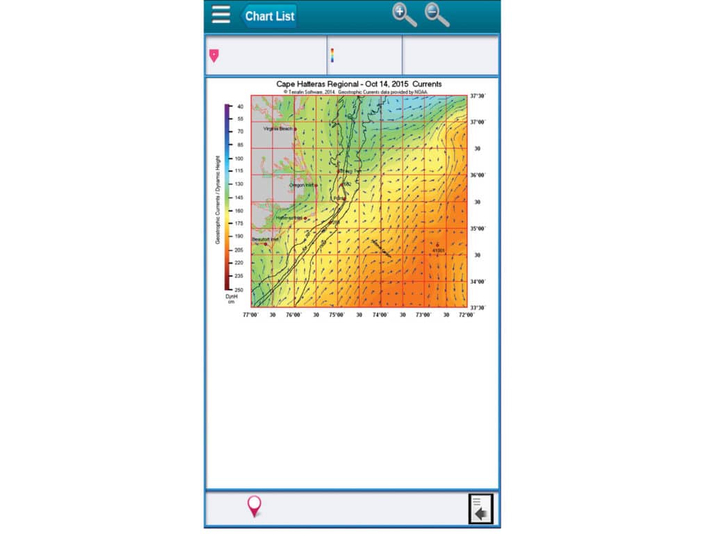
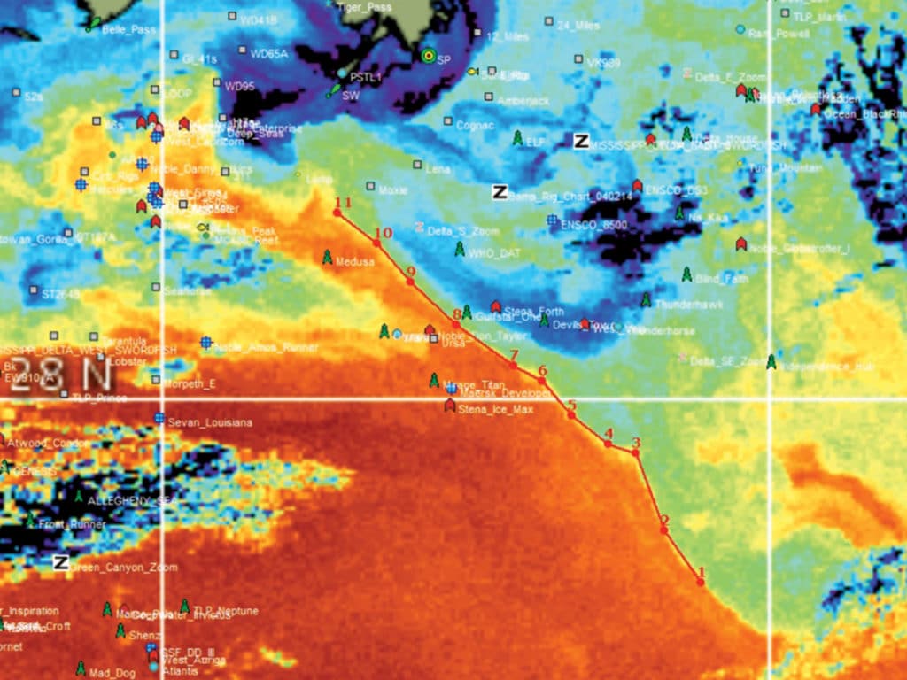
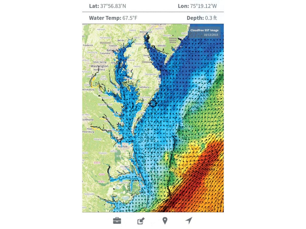
Mitch Roffer, of Roffer’s Ocean Fishing Forecasting Service (ROFFS), is an oceanographer and is in the business of interpreting satellite-derived data to make tournament-winning fishing plans for his subscribing customers (roffs.com). Sure, free sea-surface-temperature (SST) charts are available online from Rutgers University, NOAA or NASA, but fishermen often don’t dive deep enough into them to make a difference.

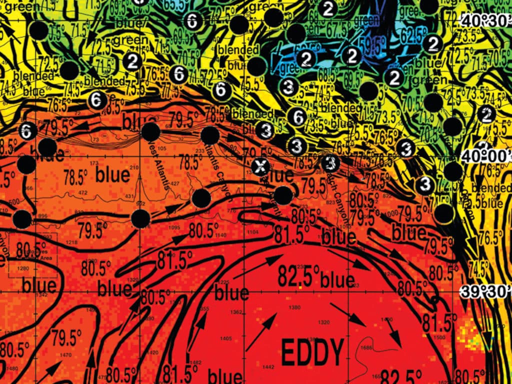
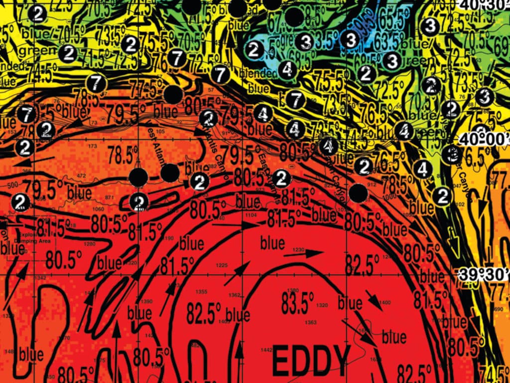
Roffer says that you first need to be sure the temperature break is in the right range for billfish — the sweet spot being 75 to 78 degrees. Then, you need to know how long the break has been there.

“A break doesn’t do much for 24 hours,” Roffer says. “It reaches its optimum in about three days. Then, you and I could catch them in a rowboat.” In five or six days, the cycle fades, likely from predator and angler pressure, and it takes a few days to recharge.

Advertisement

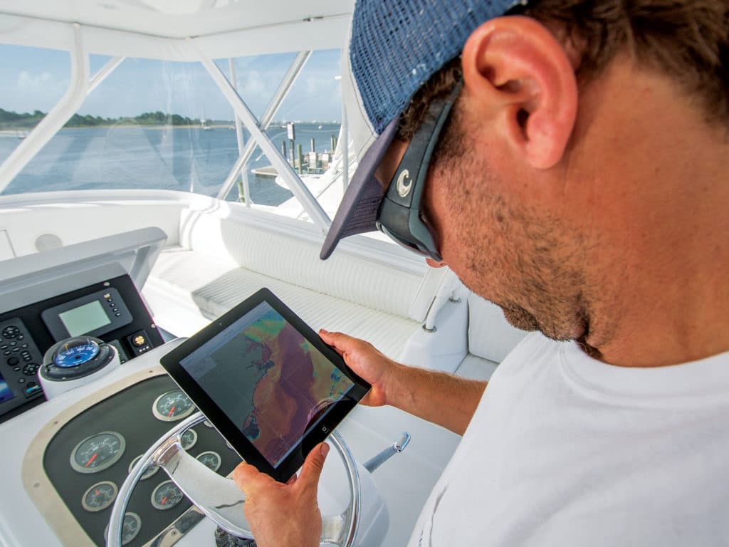
Tom Hilton offers his Realtime-Navigator online service (hiltonsoffshore.com), which not only provides satellite-imagery maps in an easily digestible form but allows anglers to plot their own fishing plan and download navigation charts into a tablet to be used offshore.

App-Based Satellite Services

Secret to Success

App-based services such as Hilton’s let anglers pack their tablets with satellite imagery and plan a course of action for success offshore. Courtesy Hitlonoffshore.com
App-Based Satellite Services

Eddy Intel

While some services offer do-it-yourself tools to create your own fishing analysis, Roffer’s Ocean Fishing Forecasting Service analyzes all sea-surface data to create a fishing plan tailored to a specific region, day and the preferred tactics of the angler. In this series, ROFFS has identified the convergence of two bluewater eddies and identified them as prime fishing waters. By referring to two or three consecutive sea-surface images, ROFFS gives anglers an up-to-date plan, but with the power to amend it based on dynamic ­changing conditions. Courtesy Roffs.com
App-Based Satellite Services

Good Temperature

A good temperature break is one ace in your poker hand. Courtesy Roffs.com
App-Based Satellite Services

Bottoms Up

When it meets good bottom structure, good currents and a water-color break, Tom Hilton believes a fisherman is playing a hand with four aces. Courtesy Roffs.com

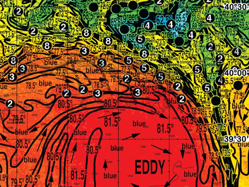
“Reading the charts is like a hand of cards; when you go out using just one image — say, a good temp break — it’s like an ace in hand. But for a winning hand, you need to rely on other parameters like water color, current and altimetry. Every time you find another favorable condition on that spot, you have another great card in your hand,” Hilton says.

To illustrate his point, Hilton charted a trip for the day I called.

Advertisement

“First, there’s an eddy off the Gulf Loop Current. I like the temperature; that’s two aces. I also found a color break along the eddy, which indicates phytoplankton. Now I have three aces. And the eddy hits the shelf, creating an upwelling right along the line of drilling rigs.That’s four aces in my hand, and I plotted a fishing course right along the confluence of these points. That’s where I’d fish if I were going.”

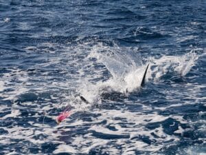
Although these guys can spoon-feed it to you, with practice, you can get the hang of looking for good temperature breaks and color changes in eddies along shelves, seamounts or oil rigs and be your own man of the hour. But who’s got the time?

App-Based Satellite Services

FishTrack

Subscribe to the FishTrack app to view sea-surface temperatures, true water color, phytoplankton, currents, altimetry and bathymetry in the palm of your hand. Even better, when you download one screen to your toolbox, it downloads all those screens and allows you to overlay one or all of them, with or without cellular coverage. Courtesy FishTrack
App-Based Satellite Services

Terrafin

Terrafin Satellite Imaging provides free sea-surface temperatures online or on your iOS or Android device. It provides current and historical charts so you can anticipate the movement of eddies and breaks. For an upcharge, view and overlay water color, phytoplankton and altimetry, and use Terrafin’s route-planning tools for pre-trip strategy. Courtesy Terrafin
Advertisement

Free Email Newsletters

Sign up for free Marlin Group emails to receive expert big-game content along with key tournament updates and to get advanced notice of new expeditions as they’re introduced.

Advertisement